|
Umpqua River near Elkton: Kellogg Bridge to Smith Bridge - by Jeff W.
I had originally picked this trip due to its proximity to Eugene and
the description of its two mile "bicycler's shuttle" in Soggy
Sneakers. What I failed to realize is that the run's length, geology
and bank ownership make it a decidedly difficult day trip.
I arrived shortly after 10am at Smith bridge to find Mari already there
and scouting for anything that looked remotely like a take-out. The
bridge is very high above the river and most of the banks are
steep and/or lined with blackberry bushes. We finally found something
suitable about an eighth of a mile downstream of the bridge, river-left,
but the road to it was posted as private property of the Big-K resort.
Clarence had arrived by then and offered to go check things out at the
resort. Turns out the going rate for using the take out is $10/boat,
but for kayaks and canoes they'll halve it to $5. Ah, the price to
paddle...
By then Horst and Joy had arrived and we set off for the put-in two
short miles up the road. Well - you guessed it - that's private
property too and cost us another $5/boat. Incidentally, the put-in is
under the south side of the Kellogg bridge: cross the bridge and take
the first right, then right again into a grassy field with a pay box
nailed to a post. A free alternative looked possible by taking a left
on the dirt road just before crossing Kellogg bridge and driving down a
little ways.
Due to the unexpected difficulties as well as some miscommunication we
didn't get on the water until 1:00pm and some of us didn't get on at
all (sorry Mari). Once we were on our way though things definitely
improved. The run is 14 miles long and consists of 1-2 mile stretches
of flatwater interspersed with class I/II+ rapids. At the low summer
flows much of the river is restricted to narrow slots cut into the
bedrock which has in turn been carved into a myriad of mortar and
pestal shapes reminiscent of the sculptures of Henry Moore. In other
places are boulder gardens with tufts of tall grass growing out of
them. Both were big fun to run when not containing hazards (most were
clear). And unlike most Oregon rivers, the water temp was a very
pleasant 70F so a dump was not altogether undesirable.
As for hazards, we only encountered two serious rapids. The first was
at the mid-point and is only a problem due to a large rock below the
drop. In an IK it isn't really an issue but drift boats and more
sensitive craft are best to line/portage it. Incidentally, its
possible to bail out at or near this rapid and walk up to the Big-K
lodge - which a tired Joy happily took advantage of. The second serious
rapid is the chute just above Smith bridge. Clarence and I took the
sneak-around (go river-right starting about 50 yards above the start of
the chute and work your way through the narrow slots; a bit boney but
quite doable) but Horst ran it in his IK. Here's what he has to say
about it:
Yes, the last rapid, just before the Smith Bridge, is class 3 at the
current level (1410 cfs/3.23 ft) *if* you run the narrow, turbulent
chute river-left. The shoot is a couple hundred feet long and has a
downstream facing log in the middle of the last quarter; because the
log faces downstream a kayak wouldn't hang up in it, but a larger craft
could get in big trouble because of lack of room to maneuver. Charley
commented that the sneak route river-right is the 'way to go' (talking
from drift boater's point of view)...
Fouteen river miles is a good deal of paddling, especially when you
going into the wind, which was the case in several places. It was
apparent that many folks were doing longer trips and camping below the
high water mark. This is probably the best approach and lets you take
advantage of the few public boat launches upstream and down for this
run. As for us, we didn't get off the water until after 8:00pm: it was
dark by the time we got back to the put-in. Although hungry, I was reluctant
to drive the four bumpy miles to the Big-K lodge and evidently missed out
on more than just dinner:
(from Horst's email)
When I entered the Big-K lodge at quarter to ten I found Joy surrounded
by 2 of the 4 daughterss of the ranch owner, several grand children,
and the only son, Charley. To greet me he stood up - but didn't seem to
stop rising ... until he finally reached the impressive height of
6'11'' ! Before they were about to close the kitchen Joy had ordered 1
vegan, 1 roastbeef, and 1 turkey sandwich plus a couple of Mirror
Ponds. I didn't mind taking care of the two meaty ones, but Jeff, your
vegan is still waiting to be picked up (just kidding -we took care of
that one too). We then sat around and listened to family stories: they
homesteaded the land; now in the sixth generation; an operating ranch,
2500 acres which included most of the land river-left that we looped
around(*).
(*) Footnote: I've often found, when pushing the envelope a bit, and not
having everything planned out in all details I often end up meeting some
interesting, local folks.
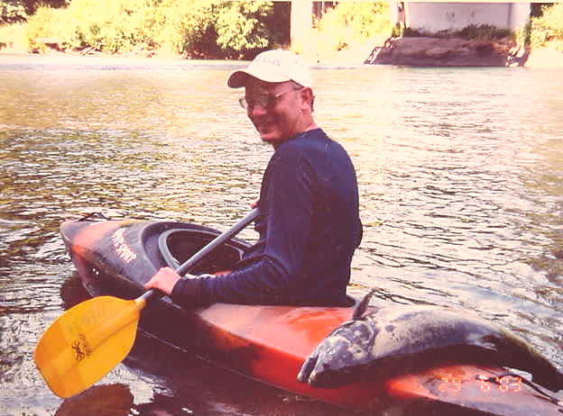
There are a few photos from the trip in the
Pic-Bucket and for
those interested in doing this stretch of the Umpqua, a map was aquired
from the lodge which I believe is available: contact Horst. Oh and
Horst - I want my veggie sandwitch!
Tahkenitch Creek: Hwy-101 Trailhead to the Ocean - by Horst
Some of you may remember my hapless attempt last August starting at
the dam near Hwy 101, just below Tahkenitch Lake. I got slowed down by
numerous log jams, and finally ended up high&dry at the Big One a few
hundred yards upstream from the trailhead put-in. In short, don't
repeat
THIS.
We then scheduled a trip on Tahkenitch Creek for the end of April but
had to cancel because of bad weather.
In mid June I gave it a third try, this time starting 100 yards below
the trailhead parking lot (daily permit ($5) or season pass required
)-: The weather was perfect but the water already a bit low.
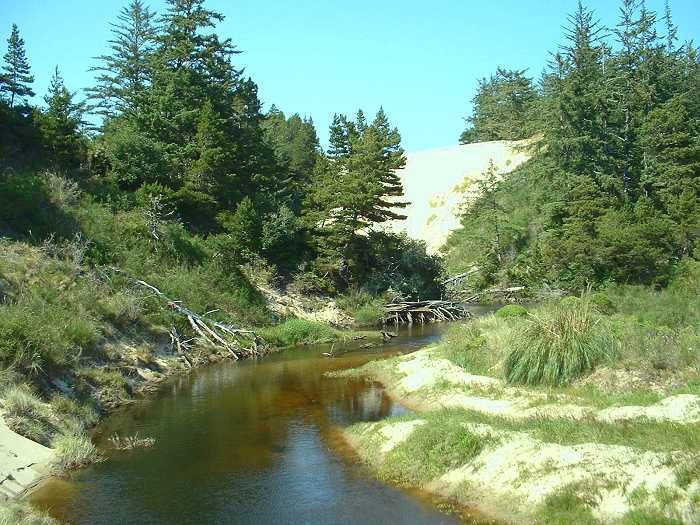
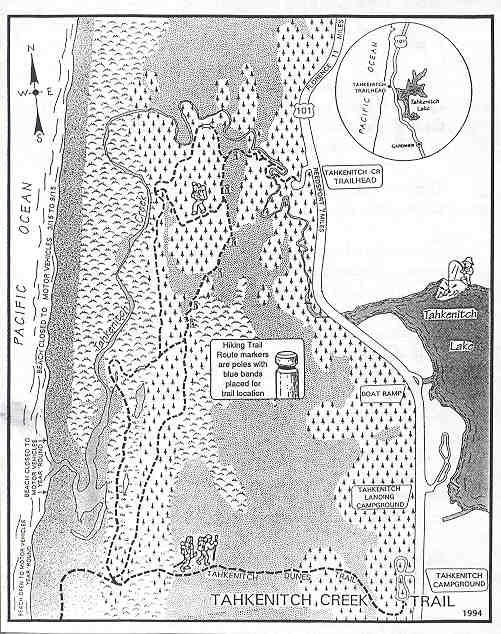
The scenery is just beautiful and remote. One can divide the entire
stretch into three sections: 1) creek meandering through dunes,
2) a wider and more open stretch following the major south turn of the
creek; this part (looking
south) is still sheltered from the ocean by low, brush covered
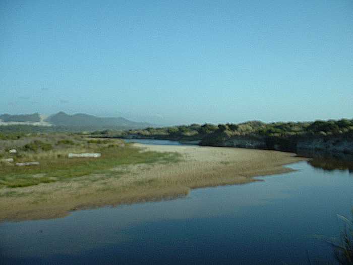
dunes, 3) the last 1+ miles, already influenced by the tide, exposed to
the ocean winds, and gradually getting wider and more and more
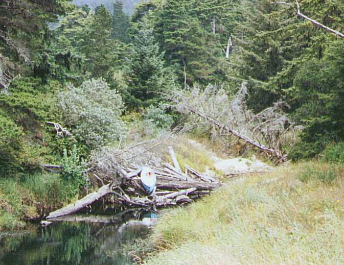
shallow. I actually had to walk the boat at several places.
There is one major log
jam in section(1) that can be portaged easily, and a few narrow
spots where you can push the boat through without unloading.
Half of section(3), river-right, is the taped-off nesting area of the
endangered Snowy Plover. An earlier question, if canoeing would
interfere with the bird's habitat, can be positively answered: No,
there is plenty of room to stay clear of the nesting area.
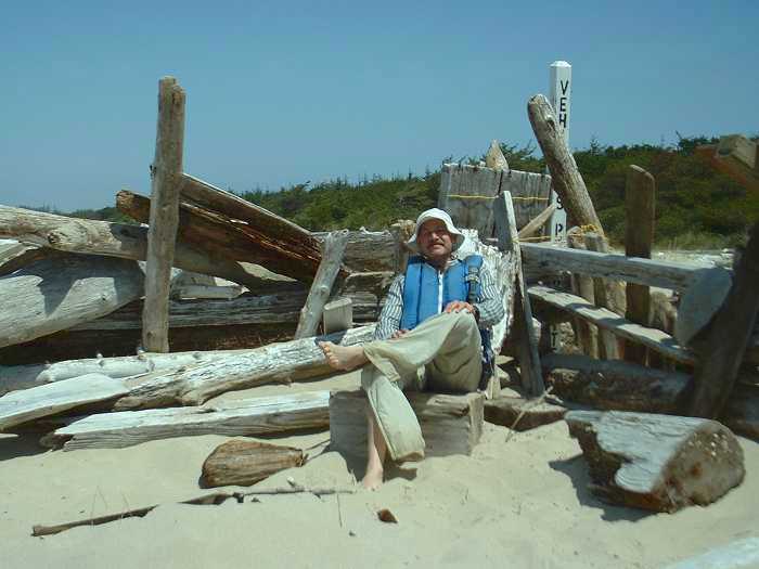
As for accommodation, I was tempted to accept the local beach bum's
invitation to stay at his driftwood
castle half a mile before the ocean. But then, being so close I
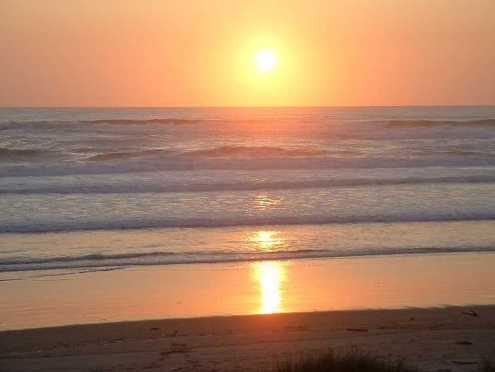
decided to portage my boat across the brush covered dunes of section(2)
and bivouacked right at the ocean, just in time to watch the perfect sunset
(inflatable kayaks make excellent mattresses!)
Other:
I have not seen official data regarding the length of this stretch;
it's probably around 4 miles. But don't get fooled, portage, shallow
stretches, wind, and noticeable current in segment(2) require more time
than an 8 mi roundtrip on flat water.
Topomap, 7.5 quadangle: "Tahkenitch Creek"
Forest Sevice link: http://www.fs.fed.us/r6/siuslaw/rec/explore/tahkenitchcr.htm
has been down while writing this, but their hiking map
is saved on our site. General contact page for Siuslaw National
Forest still works.
Rogue River: Hellgate Recreation Area - by Mari B.
We had a great time on the Rogue trip. Water was warm and daytime
temperatures hot. I actually wore a cotton t-shirt on the water and was
comfortable even though it was wet all the time. Makes me want to bag
the McKenzie!
On Friday we did an afternoon float from Ennis to Almeda. We had some
wind but not enough to bother the IKs. Saturday we went from Hog Creek
to Almeda. I was very tired by the end of the day. I don't know if it was
because of slow current or because I haven't been boating much this year
or because I didn't drink enough water. The others didn't complain.
Sunday we ran Galice to Graves Creek. Very nice stretch that I want to
do again soon. We caught it at a very nice water level.
As for individual rapids, Chair Rapid was a challenge for the hard shell
boaters. The water really pushed them against the side of the river.
Chair was easy for the IKs and I think they wondered what the deal was.
Our one IK swim was there but it was her first time in a boat.
Galice chute has rocks exposed in the middle so definitely run right of
center. Nice ride.
Argo had some rocks exposed near the bottom and was a little pushy. It
looked like a clean shot on the far right. Our group went various routes
as did the dozens of other IK'ers we watched and all did OK. I think
Argo wouldn't be as forgiving if the water level was much lower.
Almeda campground was noisy Friday night. Some folks in our group
complained to the camp host and Saturday was much better. We had 2
campsites Friday night and 3 Saturday. I think the campground was full
Friday night. I hadn't made reservations but many others had so I can
imagine finding a space late Friday would be a problem. Donna arrived
Wednesday and got our sites so we had no problems.
I rowed a cat on Sunday and it was great fun. I rented it from River
Dancer in Merlin. $35/day. It was just narrow enough that I could car
top it. Quite a sight. I liked the boat. It was a very responsive little
craft. I ferried it back and forth across some of the rapids pretending
I was trying to catch the must-catch eddie at the top of Blossom Bar.
Participants were:
- Lee and Ellen, canoe
- Diane, IK
- Jeff, kayak
- Marilyn, IK
- Mari, kayak, cat
- Donna, IK
- Dale, kayak
- Anne, kayak
- Carol, IK
- Beth, kayak
- Deb
Note from Jeff: I brought a waterproof camera along for for this
trip and will have pictures soon.
|